
 @scottjonphotography
Bungle Bungles, Wyndham and Kununurra Ground and Aerial Expedition
Scott Jon Photography and Paul Hoelen Photography
Overview
Embark on an immersive six day photographic expedition through one of the most dramatic and visually striking landscapes in Australia. This workshop explores the extraordinary sandstone formations of the Bungle Bungles alongside the vast river systems, rugged escarpments and ancient terrain surrounding Kununurra and Wyndham in Western Australia’s remote Kimberley region.
This expedition combines aerial photography, drone exploration and ground based landscape shooting across a region that reveals completely different personalities depending on how it is viewed. From the air, the Kimberley becomes an intricate tapestry of erosion patterns, geological layers and tonal contrasts that have developed over hundreds of millions of years.
A key feature of this workshop will be helicopter based aerial photography throughout the Bungle Bungles and surrounding Kimberley ranges. These flights offer rare perspectives over one of Australia’s most iconic geological landscapes, with opportunities to photograph the distinctive beehive domes, hidden gorges and sweeping sandstone formations from above.
From the ground we will explore remote lookouts, river systems and dramatic Kimberley landscapes while making extensive use of drones where permitted to reveal the scale and patterns of the terrain. The combination of aerial and ground based photography provides a comprehensive experience of this extraordinary region.
This workshop is designed for photographers who want to experience one of Australia’s most remote and visually powerful landscapes while developing their creative approach to aerial and landscape photography.
Historical and Regional Context
The Bungle Bungles – Purnululu National Park
The Bungle Bungles are among the most remarkable geological formations in Australia. Located within Purnululu National Park, these distinctive sandstone domes are believed to be more than 350 million years old and are characterised by their striking orange and black banding.
From the ground the domes rise dramatically from the surrounding spinifex plains, but it is from the air that their true scale and complexity become apparent. Hundreds of dome shaped towers stretch across the landscape, separated by narrow gorges and deep shadowed valleys that create endless photographic possibilities.
Helicopter access allows us to photograph this landscape in ways that are simply not possible from the ground, revealing the geometry, scale and ancient erosion patterns that define this UNESCO World Heritage listed region.
Kununurra
Kununurra serves as the gateway to the eastern Kimberley and provides access to an incredible range of photographic subjects. The surrounding region features vast river systems, irrigated farmland, escarpments and dramatic mountain ranges that create strong visual contrasts across the landscape.
Lake Argyle, one of Australia’s largest freshwater lakes, sits nearby and contributes to the dramatic scenery that surrounds the town. The region offers excellent opportunities for both aerial and ground based photography with sweeping views across rugged terrain that has remained largely untouched for millennia.
Wyndham
Wyndham is one of the oldest towns in the Kimberley and sits at the mouth of the Ord River where it flows into Cambridge Gulf. The surrounding mudflats, rivers and mountain ranges create a unique visual environment that is particularly striking from the air.
Nearby vantage points such as the Bastion Range provide sweeping views across the gulf, tidal flats and surrounding ranges. The combination of rivers, tidal movement and rugged terrain creates a dynamic environment that changes dramatically with light and weather conditions.
Meet Your Instructors
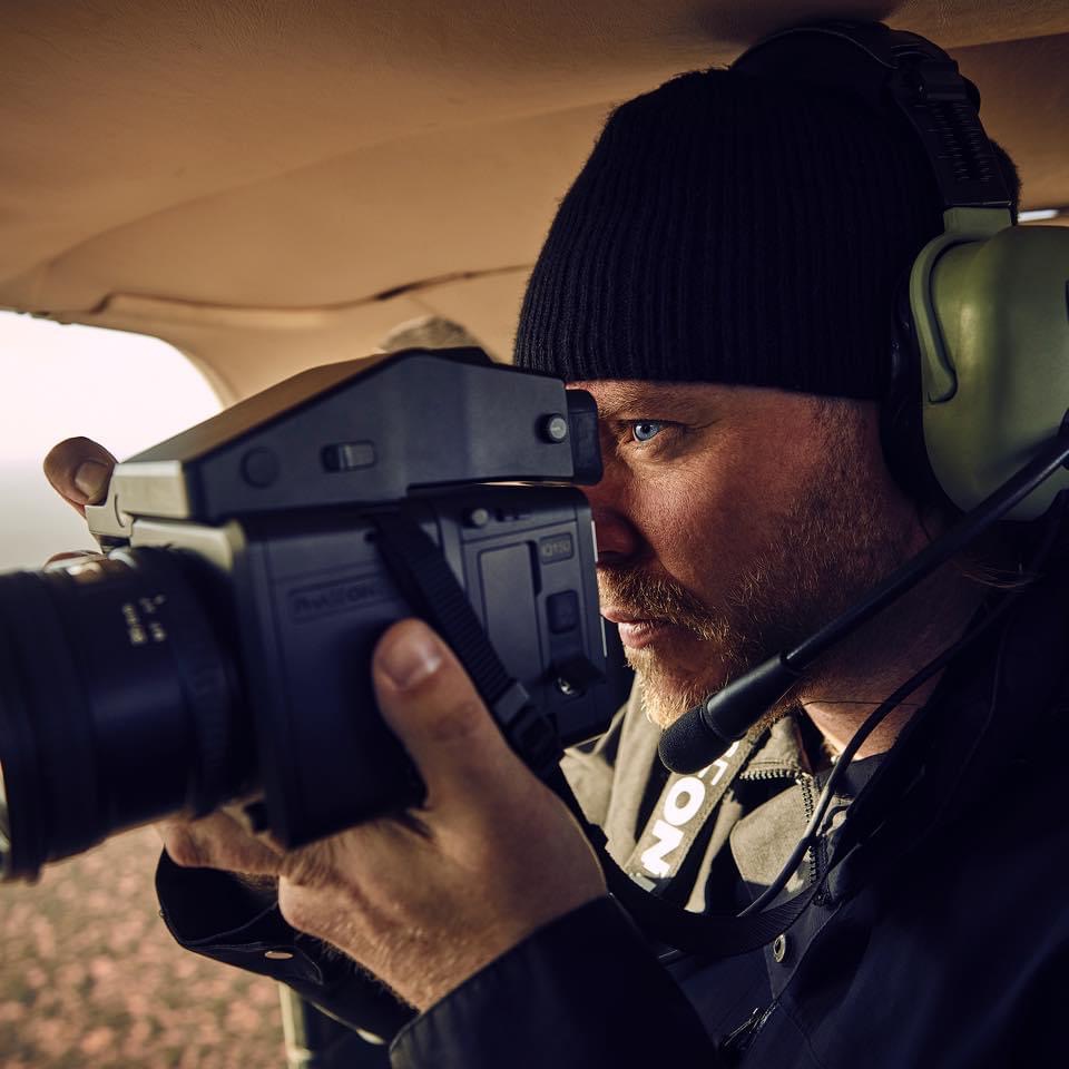

This workshop is co led by Scott Jon McCook and Paul Hoelen, two of Australia’s most experienced aerial photographers.
Scott Jon McCook has spent over a decade capturing some of the most striking landscapes in Australia and New Zealand from above. Known for his fine art aerial photography, Scott brings extensive experience in helicopter and drone based photography along with advanced post processing techniques that help transform raw captures into powerful final images.
Paul Hoelen is an award winning aerial and landscape photographer whose work has taken him across Australia’s most remote environments. Paul brings a wealth of experience in aerial storytelling, composition and visual interpretation of landscapes.
Together Scott and Paul provide a unique blend of technical knowledge and creative insight, helping participants refine their shooting techniques while developing their own photographic vision.
Workshop Details
Dates
2027 Dates TBA
Duration
5 Nights 6 Days
Locations
Kununurra, Wyndham and Purnululu National Park (Bungle Bungles)
Group Size
Maximum 4 Participants
Accommodation
Comfortable accommodation in all areas, mid to high spec with access to key locations throughout the eastern Kimberley region.
Aerial Photography
Multiple helicopter flights over the Bungle Bungles and surrounding Kimberley landscapes with doors off shooting positions.
Drone Photography
Extensive drone opportunities throughout the region where permitted.
Skill Level
Suitable for intermediate to advanced photographers with an interest in aerial and landscape photography.
Itinerary
As with all aerial photography expeditions, flexibility is essential. Weather, light and flight availability will influence the exact structure of our days, allowing us to adapt to the best possible conditions.
Day 1 – Arrival in Kununurra
Participants arrive in Kununurra where we will meet and settle into accommodation before beginning the expedition. The afternoon will be used for introductions, equipment preparation and a briefing on aerial photography techniques and safety procedures for helicopter operations.
Depending on arrival times we may also explore nearby locations for sunset photography.
Day 2 – Kununurra and Surrounding Landscapes
Our first full day will focus on exploring the landscapes surrounding Kununurra. This may include elevated viewpoints across the Ord River system and opportunities to launch drones where conditions allow.
The aim of this day is to begin understanding the landscape, how light interacts with the terrain and how aerial perspectives can be used to interpret the environment creatively.
Day 3 – Helicopter Flights over the Bungle Bungles
This day will be dedicated to helicopter based aerial photography over the Bungle Bungles within Purnululu National Park.
Participants will fly in small groups allowing each photographer clear shooting opportunities as we explore the iconic beehive domes, hidden gorges and vast sandstone formations that define this extraordinary landscape.
These flights provide an unrivalled perspective over one of Australia’s most spectacular geological regions and are often the highlight of the expedition.
Day 4 – Ground Exploration of Purnululu Region
Following our aerial sessions we will explore accessible areas of the Bungle Bungles region from the ground, photographing the towering domes, narrow gorges and dramatic sandstone formations.
Drone opportunities will be used where permitted and where conditions allow, offering additional creative perspectives across the landscape.
Day 5 – Wyndham and Cambridge Gulf
Today we travel to Wyndham to photograph the dramatic landscapes surrounding Cambridge Gulf.
This region provides powerful compositions of rivers, tidal flats and rugged ranges that stretch toward the horizon. From elevated viewpoints we can photograph sweeping landscapes that capture the scale of the Kimberley environment.
Drone photography will play a strong role here, allowing us to reveal the patterns created by tidal movement and river systems across the landscape.
Day 6 – Final Sunrise and Departure
Our final morning will be dedicated to one last sunrise shoot in Wyndam, we then slowly make our way back to Kununurra for our final goodbyes.
Participants will depart with a portfolio of images captured across one of Australia’s most remarkable landscapes.
Flexibility and Conditions
The Kimberley is a dynamic environment and conditions can change quickly. Our itinerary is designed to remain flexible so that we can take advantage of the best available light and weather conditions.
Flight times may be adjusted, locations swapped and shooting sessions extended when opportunities arise. This flexibility allows us to maximise the photographic potential of the region and ensure participants experience the best possible conditions during the expedition. So in summary the itenrary is only a very rough guide, Paul and I like to keep things dynamic and flexible just like when we goto these regions on our own, this allows us to always be in the best position at the best time.
How to Book
If this expedition sounds like something you’d like to be part of, simply click the Book Now button at the top of the page. This will send an email enquiry directly through to me and from there we can start the conversation about getting you on board for the trip.
If you’d prefer a quicker chat, feel free to hit the Start Chat button (bottom right) to send me a message on WhatsApp. I’m always happy to answer questions, talk through the itinerary, flights, gear or anything else you’d like to know before committing.
With only four spots available, this will be a small and highly personalised expedition.